Post Mountain, Trinity County, California
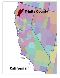 Setting: Post Mountain, a subdivision 15 miles southwest of the town of Hayfork, is a 3,000 acre tract of land divided into 1,000 lots, currently with 250 full time residents. A maze of private and USFS roads and thick forests make it difficult to locate residences, but as more move in it becomes increasingly important to protect the area, identified as a priority in the Trinity County Strategic Fire Management Plan-Community Wildfire Protection Plan.
Land Ownership: Trinity County has more than 70 percent of its land area administered by the federal government, primarily the USFS. In 1997, 99.2% of private timber land in the county was owned by entities outside of the county.
Vegetation Type: Forests in the area are diverse. Overstory confer species include ponderosa pine, Douglas fir, incense cedar, sugar pine, Jeffrey pine, and white fir. A subcanopy of evergreen hardwoods – Pacific Madrone, golden chinquapin, canyon life oak, big leaf maple, white oak and dogwood – can be found, depending on elevation, moisture and substrate. Stands of knobcone pine and chaparral dominate sites recently burned by high-severity fires. The climate is characterized by warm, dry summers and cool, wet winters; thunderstorms occur in the dry season and lightning is a common cause of fire.
Fire History and Occurrence: Like many other regions in the West, fire has played an important role in the maintenance of historic ecosystem health and diversity. Native Americans used fire to promote production of acorns, berries, roots, and fiber, and to improve hunting conditions. In the past century, Euro-Americans’ exclusion of fire, logging practices and planting of single species plantations have altered natural fire regimes. Fuel loading in most forests is extremely high – surface, ladder and crown fuels contribute to the likelihood of unpredictable and catastrophic wildfires. Stand density is also leading to a general decline in forest health, including disease and insect related tree mortality.
Wildfire is no stranger to Trinity County. The first large-scale catastrophic fire in Trinity County was the Hayfork Summit Burn which burned approximately 19,000 acres in 1963. The Siege of ’87 burned 54,000 acres of forestland on the Hayfork Ranger District (nearly 19% of the land base) and 67,000 acres overall. The Barker Fire of 1992 burned 5,600 acres and the Hyampom Fire of 2001 consumed more than 1,200 acres and forced hundreds of residents to evacuate. The Prairie Fire in 2003, only 54 acres before it was contained, reburned the area burned in 1987. The Oregon Fire, located two miles west of Weaverville, the county seat, started in August, 2001 and was featured on the front cover of The New York Times with a photo of people viewing from lawn chairs on their roofs. The fire destroyed 13 homes, caused extensive evacuation, and burned 1675 acres of private and public land. This fire galvanized the county to support the USFS Fire Management Plan and the Fire Safe Council plan.
 The Trinity County Fire Safe Council: The Trinity County Fire Safe Council (FSC), part of a state-wide network of organizations for wildfire planning and educational outreach to homeowners, was initiated in 1998. The Trinity County FSC has benefited from several ongoing efforts involving multiple agency and community participation and has been recognized for its collaboration. A Hayfork Fire Plan was developed from 1995-96 in a joint effort by the Watershed Research and Training Center (WRTC), Trinity County Resource Conservation District (TCRCD), United States Forest Service (USFS), California Department of Forestry (CDF), and local residents. The collaboration was funded by USFS Pacific Southwest Research Station and led to a proposed plan to develop fuel breaks around the community of Hayfork.
Coordinated fuels reduction and fuel break construction efforts began with private landowners in two Hayfork area neighborhoods, and WRTC worked with USFS to construct some of the identified fuel breaks on federal land. WRTC has pioneered efforts to make fuels reduction economically sustainable through utilization of small diameter wood in manufactured wood products. WRTC and TCRCD have also developed in-house GIS capability. These and other efforts have served to develop local organizational capacity for working with private landowners and local residents to identify values at risk and reduce fuels hazards on private lands, and to implement fuel reduction on public lands using non-profit resources.
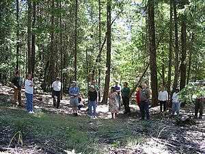
Post Mountain CWPP Process: In 2001, Post Mountain community leaders began working with the Trinity County FSC and WRTC to start planning and implementing an initial wildfire protection plan. The objectives were to:
- teach residents about defensible space and clearing lines around their properties
- reduce fuels loads and ladder fuels that carry forest fires
- increase safe access for firefighters during suppression efforts
- increase the number of escape routes for firefighters and local property owners during an incident.
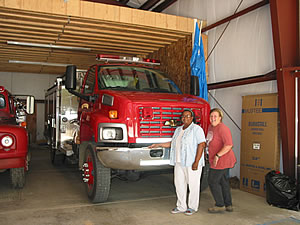
The BLM Community Assistance Program has contributed $50,000 to the Post Mountain Volunteer Fire Department for implementing a public education campaign and fuels reduction on private lands. USFS projects have continued this work with roadside fuels management zones crossing ownership boundaries in the subdivision. Now in its third year, one USFS project has already completed fuels reduction on almost 150 acres along roadways, ridge tops and private land boundaries throughout this wildland urban interface. Along with reducing the ladder fuels, this project improves access for firefighters and provides anchor points in suppression efforts and safe escape routes during emergency situations.
 Participants: Post Mountain Volunteer Fire Department, Post Mountain Public Utilities District, the Shasta-Trinity National Forest (USFS), TCRCD, Trinity County FSC, the local environmental community, interested forest contractors, county officials and community members participated. WRTC contributed technical assistance for grant applications, ecological monitoring, GIS mapping and meeting facilitation. WRTC secured a Title II grant from the Resources Advisory Committee to fund its crews for fuels reduction work, both by hand and with a new technology such as the Slashbuster and ASV Positrac which can remove small diameter materials with minimal soil disturbance.
Current Status: The Post Mountain Stewardship Collaborative was established in 2004, building off earlier momentum and engaging the broader community in planning a collaborate project with the local FS District and capitalizing on newly authorized stewardship contracting. Forest restoration activities, including wildlife habitat enhancement, and local workforce improvement are important elements of the project, along with reduction of hazardous fuels, increased safety and protection. Post Mountain’s Community Wildfire Protection Plan was recently submitted as an appendix of the Trinity County CWPP.