Larimer County, CO
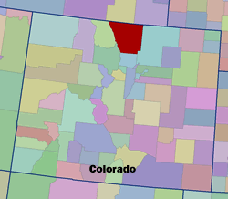 Setting: Larimer County, Colorado is located along the Front Range of the Rocky Mountains, approximately 6f0 miles north of Denver. Its total population is estimated to be, according to 2000 census data, 251,226, with 68,819 persons living in unincorporated areas of the county.
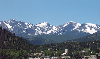
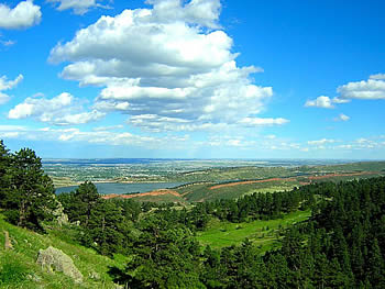
Land ownership: The total size of the county is 2,640 square miles. Over 50% of the county land is publicly owned, mostly managed under the jurisdiction of the Arapaho-Roosevelt National Forest and Rocky Mountain National Park.
Vegetation Type: A number of vegetation types are represented in Larimer County and correspond to elevation gradients. At the lower elevations in eastern Larimer County (4,000-6,500 feet), shortgrass steppe mixed with semi-arid shrubs predominate. Nearly pure stands of Ponderosa pine occupy what is called the Lower Montane from 6,500-8,500, while denser stands of Ponderosa pine mixed with Douglas-fir and other conifer species comprise the Upper Montane from 8,000-9,500 feet. At 9,000-11,000 feet, subalpine forests made up of spruce, fir, and Lodgepole pine are found. Above 11,000 feet is alpine tundra where trees generally do not persist.
 Fire History and Occurrence: On average, over the past twenty years or so, 161 wildfires burn over 2200 acres each year in Larimer County. In “slow” years, such as 1996, wildfires are relatively small and, though many homes may be threatened, no homes burn. At the other extreme is a year like 1994 when 340 fires, including the Hourglass Fire which destroyed 13 buildings at Pingree Park, burned through Larimer County. In addition to destroying 13 buildings at Pingree Park, the Hourglass Fire threatened 12 homes in the Poudre Springs area. The Snowtop Fire, in July 1993, threatened at least 5 homes in Cedar Park. In 1995, a relatively wet year, the Bonner Peaks Fire threatened 8 homes west of Highway 287. During the summer of 1996, several fires ranging in size from one acre to 180 acres, threatened 50 to 60 homes throughout Larimer County. From 1985 to 1996 fires burned a low of 156 acres in 1992 to over 11,000 acres in 1988. Historical records show that, 2% of all wildfires reach 100 acres or more in size.
CWPP Process: There is one general county plan (not a CWPP), and individual communities have been creating their own CWPPs, presumably with WUI zones that surround their specific community. Until this point, communities have been developing their plans internally with the assistance of the Larimer County Coordinating Group (LCCG). However, there are currently two communities in the pre-planning phase that may hire an external consultant to assist them.
The LCCG serves to coordinate actions taken between the members, and provides resources such as maps and technical information to communities. They encourage interested community members to organize among themselves and notify the county or CSFS when they require technical assistance. The LCCG provides a unique example of federal, state and local agencies joining as a unified body; the understanding is that each member has the authority and knowledge to represent and speak for the others.
 Participants: The Larimer County Coordinating Group consists of the USFS, NPS, CSFS, and Larimer County wildfire specialist. Individual community CWPPs are created by community members with the technical assistance and support of the coordinating group; thecounty wildfire specialist and/or the CSFS members represent the LCCG in supplying resources to the communities.They pooltheir knowledge regarding CWPP development within thecounty in order to achieve efficient landscape-scale treatments and consistent qualifications for implementable plans. They agree as a team what CWPP proposals will be sent on to higher authorities for consideration for grant funding.
Status: The CWPPs being created in Larimer County provide good examples of grassroots activity supported by an organized inter-agency team. They encourage interested communities to organize and write their plans themselves, and view their role as providing technical and scientific information when the community asks for it. They emphasize the importance of community-driven plans.