Josephine County, OR
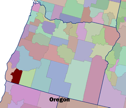 Setting: Josephine County is located in Southwest Oregon on the border with California. Its population was 75,700 in 2000, according to the US Census. Grants Pass, the largest of the county’s two incorporated cities, had a population of 23,000 in 2000. Out migration of youth seeking job opportunities has been balanced by in migration of mostly retired seeking quality of life until the past four years when population climbed sharply, much of it in the Wildland Urban Interface.
Land Ownership: The total area of the county is approximately 1,040,000 acres, of which 705,000 is publicly owned (40% USFS, Siskiyou National Forest, 27% BLM Grants Pass Resource Area, and 1% ODF, State of Oregon Forest Lands). Also in the County are the Oregon Caves National Park, portions of the Kalmiopsis Wilderness and the Illinois and Rogue Wild and Scenic Rivers. Five timber companies own about 8% of the county’s land.
Vegetation Type: The county is in a heavily forested region with twenty-eight different coniferous species, twenty of which are used commercially, including Ponderosa pine, Douglas fir, white fir, Western hemlock, sugar pine, Port Orford cedar and Shasta red fir. The Siskiyou is the most floristically diverse National Forest in the country, hosting some extraordinary botanical resources, including many rare and endangered plants. Winters are wet and cool at higher elevations; summers are hot, characterized by long periods of drought and punctuated by electrical storms. Grants Pass averages 32 inches of precipitation annually.
 Fire History and Occurrence: Fire has been an important natural process in the maintenance of historic ecosystem health and diversity. Natural fire regimes have been altered by management activities including fire exclusion, livestock grazing and timber harvesting, as well as climate variability and global climate change. Indian tribes, including the Takilma, Modoc and Shasta, used fire to enhance production of subsistence resources – hunting, gathering and crop management – as well as for warfare, felling trees and travel. Five different fire regimes have been identified in the region, varying according to vegetation and elevation, which ranges from 1200-7000 feet.
The 470,000 acre Biscuit Fire in 2002 spurred the county to initiate the fire plan. Wildfires have occurred in successive years, including the Upper Powell Creek Fire which burned 262 acres in 2003, the Redwood Highway Fire which burned approximately 25 acres in 2004, threatening over 200 homes and destroying one home, and the Deer Creek Fire which burned 1500 acres in 2005.
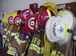
 CWPP Process: The County community development director led with his vision, “To change the culture of how people in Josephine County think about wildfire.” He contracted with a retired Forest Service fire manager and Resource Innovations, an organization focused on community fire planning and working with rural communities from the University of Oregon,to facilitate the collaborative planning process. Fire Districts and County Emergency Management were brought in as core partners; federal agencies participated on the Risk Assessment and Fuels Reduction committee, which identified and prioritize mitigation actions, coordinated fuels treatment projects across the landscape, and is currently identifying opportunities for marketing and small diameter utilization. The Education and Outreach committee developed strategies for increasing citizen awareness and action. Special effort was made to coordinate the programs for equitable access across fire districts and to provide low-income and special need citizens with opportunities to participate in fuel reduction and emergency planning activities. Coordinated post-fire response was an important goal for those who had worked on the Biscuit Fire, as was leveraging funding for fuel reduction. The fire planning process’s success was attributed to the facilitation and resources from Resource Innovations.
Participants: In addition to the County, the key partners in the Josephine County Integrated Fire Plan (JCIFP) include the following agencies and organizations:
- Bureau of Land Management
- USDA Forest Service
- Rural Fire Protection Districts
- Grants Pass Department of Public Safety
- Oregon Department of Forestry
- Oregon Office of the State Fire Marshal
- Oregon Department of Transportation
- Siskiyou Field Institute
- Illinois Valley Community Development Organization
- Applegate Partnership
- Illinois Valley Forestry Action Committee
- Seven Basins Neighborhood Fire Council
- Sunny Wolf Community Response Team
- Williams Educational Coalition
- Josephine County Special Needs Committee
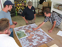
Current Status: The fire planning process began in August 2003, was completed in November 2004, and adopted as a CWPP by the Board of Commissioners, the Oregon Department of Forestry and the Josephine County Fire Defense Board. In 2004, in cooperation with the JCIFP, three non profit groups received National Fire Plan (NFP) grants and conducted fuels reduction on 465 acres of private land. In 2005 Josephine County received $500,000 in funding from NFP and completed 500 acres of hazardous fuels reduction projects in three communities. The county also received additional funding from Title II of the Rural Secure Schools Act to fund defensible space for low-income and elderly or disabled citizens in the county. The Bureau of Land Management has also coordinated public land fuels reduction with these projects on private land. JCIFP committees continue to meet, expanding outreach and education, and monitoring progress in implementation of objectives. JCIFP coordinates with the Applegate and Illinois Valley communities who have completed fire plans and adjacent Jackson County which has recently adopted its CWPP.