
City of Ashland, Jackson County, Oregon
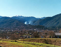
 Setting: Ashland, population 20,000, is nestled at the bottom of the Ashland watershed in the Siskiyou Mountains. The city is located in Jackson County, 195,000 population according to the 2005 Census; a growth of 7% since 2000. The total area of the county is approximately 1,802,880 acres (2,182 square miles) acres, 84% covered by forests of various compositions.
Land Ownership: Ownership of the 15,000 acre Ashland watershed is 98% USFS, 2% City of Ashland.
Topography, Climate and Vegetation: The topography in and around Ashland is dissected into steep drainages and narrow ridges. Rainfall in Ashland averaged 19.15 inches per year from 1948-1992 but the range of precipitation during the same period was 10.22 inches to 30.13 inches. Successive years of drought are not uncommon. The Mediterranean climate of Ashland is characterized by hot, dry summers with the majority of rain falling from October through May each year. Vegetation is diverse and highly dependent upon changes in soils, topography, and elevation, which ranges from 2,000 to 7,000 feet. Mixed conifers dominate lower elevations and are experiencing widespread mortality due to drought and insects.
 Fire History and Occurrence: The majority of wildfires in the Ashland Watershed during the last century have started at lower elevations within the WUI and burned into the watershed in response to wind patterns, slope, aspect and vegetative patterns. Other than the 1959 fire which burned 4,700 acres and whose scars are still visible in the hills near town, there has not been a large fire in the Ashland watershed. Fires on the other side of the valley and in view of most residences have burned many summers; smoke and ash from fires in the Rogue Valley blow into Ashland most summers.
CWPP Process: The city of Ashland has a long history of collaboration with the Forest Service, beginning with a cooperative agreement in 1929 which established shared responsibility to protect water quality. Ashland residents value their adjoining forest for its recreational opportunities, scenic backdrop and biological diversity. Limited management activity, due to citizen concern about timber harvests and potential impacts upon water supply, combined with fire suppression and increased mortality to intensify the threat of catastrophic wildfire. In 1996, the Ashland Ranger District proposed the 1,500-acre HazRed (short for hazard reduction) Project with the goal of expanding an existing shaded fuel break system. Local citizens and environmental groups protested due to the number of large trees slated for removal; in response, the District Ranger held a number of community dialogue meetings. Out of this process emerged the Ashland Watershed Stewardship Alliance and their citizen alternative for the EIS, which formed the foundation, in modified version, for the subsequent Record of Decision. Implementation of this FS project stalled for a number of reasons, not the least of which was the expense; meanwhile, the City of Ashland successfully completed a fuel reduction commercial sale on 650 acres of its land in the watershed, and obtained over $542,000 dollars in National Fire Plan grants to help interface landowners reduce fuels.
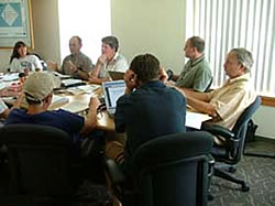 In April of 2004, the Ashland Forest Resiliency Project was designed by the Forest Service as a pilot HFRA project to treat nearly 9,000 acres in and around the watershed, including some areas already identified by the Stewardship Alliance. Prior to the release of the DEIS, the District Ranger, anticipating concern about the project, contacted the environmental community and city administrators and suggested they develop a community alternative to allow for greater input regarding treatment methods and implementation, and a CWPP to provide support for the alternative. This effort was intended to build communication between the agency and community leaders, and to facilitate an understanding of the HFRA process.
Participants: City of Ashland (Fire & Rescue, Public Works Dept., Forest Lands Commission, contract forester), Headwaters, Klamath-Siskiyou Wildland Center, World Wildlife Fund, The Nature Conservancy.
Current Status: The CWPP was completed in the September, 2004, under the time pressure created by the USFS deadline for the citizen alternative. Two subcommittees, the CWPP Steering Committee and the Ashland Forest Resiliency Community Alternative Technical (AFRCAT) Committee, drafted the 176-page plan, the last chapter of which is the 140-page citizen alternative. The anticipated date for release of the Forest Resiliency Project final EIS is 2008.