El Dorado County, CA
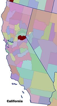 Setting: El Dorado County, California is located in central California and ranges from the foothills along the east edge of the Sacramento Valley to the crest of the Sierras and the western and southern shores of Lake Tahoe. Its total population in 2000 was 156,299 with 123,080 living in unincorporated areas (78.7%). The population includes two incorporated cities, Placerville, the county seat located in foothills with a population of 9,610 in 2004 and South Lake Tahoe with 23,609 in 2004.
Land ownership: The total size of the county is 1,788 square miles. Approximately 60% of the land is publicly owned, most managed under the jurisdiction of the Eldorado National Forest (58%) and about 2% administered by the Bureau of Land Management. The BLM lands are generally in the foothill areas along with most of the private lands.
Vegetation Type: Several vegetation types occur in the county and correspond to elevation gradients. At lower elevations of the Sierra foothills (1,000-2,000 feet) the vegetation is mostly annual grass-Blue Oak chaparral with some drier pine vegetation (depending on aspect). Mid-level is dominated by oak woodland and oak-conifer-shrub and in upper levels (eastern half of the county), Sierran mixed conifer (Ponderosa, Jeffery, and Lodgepole pine), and fir forest cover types dominate up to elevations reaching 9,000 feet. Much of the highest regions are dominated by glaciated granite ridges and basins with sparse forest vegetation.
Fire History and Occurrence: During the past 20 years the county has experienced several major fires. The Eight Mile Fire in 1985 burned 14 homes and the 1992 Cleveland Fire burned 40 homes. From 1991 to 2000, El Dorado County had four significant wildfires and a similar number of significant fires from 2000 to 2004. In addition two major wildfires burned just outside the county on both the north and south sides.
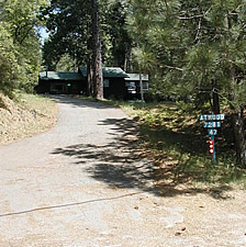
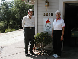 CWPP Process: In El Dorado County we focused on the CWPP process in two communities: Auburn Lake Trails (ALT) and Grizzly Flats. Auburn Lake Trails is a gated subdivision, population approximately 2,800 residents, with the ability to charge residents for services that are carried out by a paid staff. Grizzly Flats (approximately 580 homes) lacks any formal social organization as a community, but does have a local post office an elementary school, and a water district. Any efforts to expand services or carry out projects must depend on community volunteers or partnerships with extra-local agencies and organizations. For the most part, the 17 individual communities at risk in the county have been creating their own CWPPs, but they are supported in their efforts by the El Dorado County Fire Safe Council. The county Fire Safe Council, which has developed a county CWPP, has been active in facilitating grants and organizing local/community Fire Safe Councils. In California, implementation of CWPPs is supported by several statues including PRC 4291, which requires 100 feet of defensible space around every home in unincorporated communities.
 Participants: California is unique in having a network of state, county, and local Fire Safe Councils that form the foundation for any CWPP effort. The El Dorado County Fire Safe Council provides resources to local communities and serves as a non-profit that can manage funds received from grants. Local representatives of the California Division of Forestry have played an active role in initiating some CWPPs by acquiring grants and hiring consultants.
In Auburn Lake Trails, private consultants wrote the CWPP in consultation with the Board of Directors and members of the Auburn Lake Trails Property Owners Association. California State Parks, Bureau of Reclamation, and El Dorado County Fire Protection District have also participated in the ALT process. In Grizzly Flats, the local Fire Safe Council worked with a consultant to develop a CWPP. The El Dorado County Fire Protection District has participated in the process, and local water board has provided an organization to facilitate communication among home-owners.
Status: Implementation of the ALT CWPP is carried out primarily by ALT Property Owners Association staff. California Department of Parks is clearing a shaded fuel break on Bureau of Reclamation Land adjacent to the subdivision, and a group of approximately 50 residents serve as Volunteers in Prevention (VIPs) to assist local homeowners in reducing fuels on their properties. ALT is a Firewise Community, and efforts to create defensible space are informed by Firewise guidelines. The Grizzly Flats CWPP places a priority on identifying and developing evacuation routes, reducing fuels along these routes, and educating homeowners about fire risk and mitigation practices. The local Fire Safe Council is seeking grants to fund the necessary projects to accomplish these goals. Forest Service Projects on the south and east side of the community have reduce fuels on adjacent lands.